Royal Canal Greenway
 Cloondara with Longford Branch





Overview
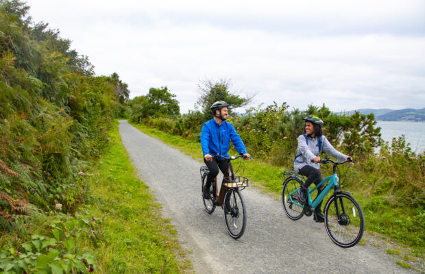
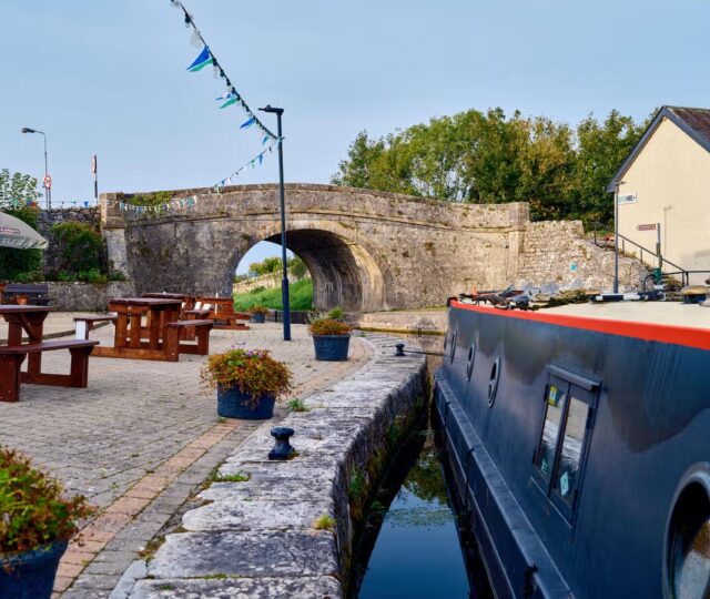
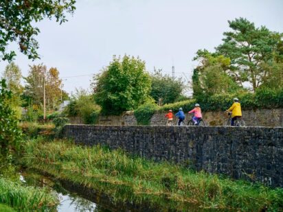
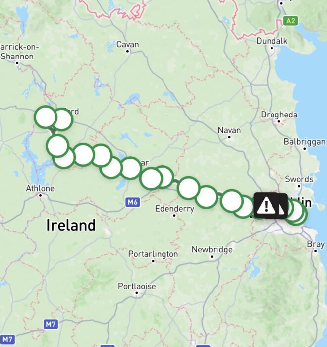
The Royal Canal Greenway is layered upon a remarkable heritage asset, which has been reimagined for a 21st century audience. Engineering marvels of a by-gone era, the characteristic canal structures of cut stone bridges, aqueducts, harbours and working locks of this historical canal system have stood the test of time. The route follows the towpath running alongside the Royal Canal with the path originally constructed to allow horses to tow boats along the canal by rope. The 147-kilometre route is Ireland’s longest off-road walking and cycling route. The route follows this 19th century canal from Spencer Dock in the heart of Dublin City through the midlands to Cloondara in County Longford. Visitors will pass through many towns and villages with cafés, picnic spots and attractions along the way. Rustic and industrial landscapes combine, with rolling fields, pretty waterside villages, working locks and historic landmarks. The Greenway also links to train services in several towns, allowing visitors to combine cycling or walking with rail travel.
The route surface is generally either a smooth tarmac surface or compacted gravel apart from approximately seven kilometres between Leixlip (Confey) and Castleknock. Caution should be taken on travelling on this section as it has an uneven surface.
Spencer Dock to Castleknock
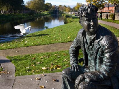
The greenway begins at Spencer Dock in Dublin’s Financial District, a short distance from Connolly Station. Built in 1873 to accommodate freight shipping, the dock retains features that reflect its industrial docklands heritage. Passing the Luke Kelly statue, the route quickly becomes off‑road, following the Royal Canal as it weaves west through the city. The route passes close to Croke Park—care is required when crossing junctions in this busy urban environment. A statue of Brendan Behan marks the transition into Drumcondra. This section can attract high numbers of users, and courtesy and caution are advised.
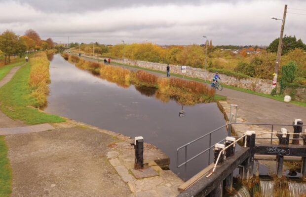
Continuing through Glasnevin and Cabra, the greenway passes under Broom’s Bridge, closely associated with mathematician William Rowan Hamilton, who formulated quaternion multiplication here during a canal walk and memorably carved the formula into the bridge. As the canal continues west, the surroundings become increasingly suburban. This section features a notable concentration of locks and murals depicting historic canal transport using barges and draught horses. The canal corridor supports a range of urban birdlife, including mallards, moorhens, mute swans and herons.
Road noise increases temporarily as the route passes beneath the M50, where the canal is carried through a distinctive aqueduct structure. Beyond the motorway, the character shifts again at the quieter 12th Lock, shortly before reaching Castleknock.
Road noise increases temporarily as the route passes beneath the M50, where the canal is carried through a distinctive aqueduct structure. Beyond the motorway, the character shifts again at the quieter 12th Lock, shortly before reaching Castleknock.
Castleknock – Leixlip (Confey)
Leixlip (Confey) – Enfield
Enfield – Mullingar
Mullingar – Ballymahon
Ballymahon – Cloondara

Need to Know
Route Characteristics and Constraints
The route is generally flat with few width restrictions. However, there are several locations where users may encounter constraints.
There are 38 road crossing points on the Royal Canal Greenway between Maynooth and Cloondara. These crossings can be steep and compressed in nature, requiring users to cross both single- and dual-carriageway roads to rejoin the greenway.
There are 15 pinch points where the greenway passes beneath road bridges. These underpasses can be constrained in width.
Surface Conditions
The section between Coolmine and Castleknock railway stations (approximately 1.5km) has an uneven surface. The route is narrow and is characterised by a steep embankment and overhanging vegetation.
The section between Coolmine and Confey railway stations (approximately 7km) has a predominantly grass surface, which can be rutted in places.
Download Your Route
Amenities
- Train Station
- Bus Stop
- Refreshments
- Accommodation
- Restaurant
- Parking
- Toilets
- Shop
- Food & Drink
- Bike Hire
- Tourist Information


Route connects with…
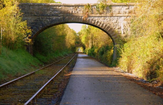
Old Rail Trail Greenway
The Royal Canal Greenway has features such as back drains, millponds, towpaths, hedgerows and is host to a rich diversity of habitats and species as it crosses through areas of rich calcareous grasslands, old, raised bogs and woodland. The ecological importance of the canal has been identified by National Parks and Wildlife Service for the diversity of species along its linear habitats.
Habitats along the greenway include tall herb, reed fringes, hedgerow, scrub, and open water. Species include Marsh Fritillary Butterfly, Wild and solitary bees, Dragonfly and Damselfly, mammals such as Otter, Badger, Pine Marten, Stoat, Fox, and Bat species including Daubenton’s, Leisler’s, Common Pipistrelle and Soprano Pipistrelles. Additional species to be found include Native White Clawed Crayfish, Smooth Newts, Frogs, and snail species such as Vertigo moulinsiana.
The canal is home to many bird species including Swan, Kingfisher, Heron, Coot, Moorhen and Mallard and fish species such as Perch, Pike, Roach, Rudd, Tench, Bream, and various course hybrids. Hedgerow are often dominated by Hawthorn and also include Spindle, Guelder-rose, Alder, Silver Birch, and Ash. The vegetation of the towpath is usually dominated by grass species.

Code of Conduct
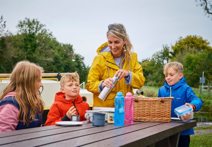
To keep our greenways welcoming and safe for all users—walkers, cyclists, families, and wildlife alike—please review our Code of Conduct before you go.
Read Code of ConductGetting There
Whether you’re travelling by train, bus, or car, use these tools to plan your route.
Common Questions
The Royal Canal Greenway has the following main entry points:
Maynooth (53.37816, -6.5912)
Enfield (53.41535, -6.83613)
Mullingar Harbour (53.52566, -7.33217)
Cloondara (53.73156, -7.90534)
Longford (53.72252, -7.79766)
There are other access points along the route however it is encouraged that users enter from the trailheads.
The Dublin to Sligo intercity train stops in Maynooth, Kilcock, Enfied, Mullingar, Edgeworthstown and Longford. There are commuter train services at Maynooth, Leixlip (Louisa Bridge), Leixlip (Confey) as well as several stops in County Dublin.
For further information on times visit: https://www.irishrail.ie/en-ie/travel-information/visiting-ireland/royal-canal-greenway
For bus services along the route visit: https://www.transportforireland.ie/
Parking is available at all of the five main trailheads.
There are no EV charging at the five main trailheads but can be found along the route.
The trail surface is a mixture (approximately 50:50) of macadam and a compacted gravel. Asphalt sections predominate in the urban areas and around bridges and access points. There is one section (approximately seven kilometers) located in County Dublin that has an uneven surface. There is generally a wide path between Leixlip (Confey) and Clonsilla with a grassy and at times rutted surface. The section between Clonsilla and Castleknock is quite narrow with an uneven surface, steep embankments and overhanging branches along the towpath.
There are no water facilities along the greenway.
There are bike parking facilities at Maynooth Harbour, Moyvalley Bridge, Mullingar Harbour, Ballybranagan Harbour and Cloondara Harbour. Each area has approximately 4 bike stands at each location.
There is a bike repair station in Enfield.
There are four bike hire operators based along the Royal Canal Greenway:
– Midlands Cycle Hub, Lough Shever Park
– Ballymahon Greenway Cycles, Ballymahon
– Mullingar Bike Hire, Mullingar
– OE Bike Shop, Mullingar
Further details on these services can be found online at https://www.waterwaysireland.org/our-waterways/royal-canal/royal-canal-greenway?accordionId=w030-accordion-label-1
Any reference to specific bike hire operators should not be regarded as a recommendation for their services.
There are numerous benches and seats along the route.
Public toilets are situated at Waterways Ireland’s service blocks in Enfield, Mullingar, Ballynacarrigy, Abbeyshrule and Cloondara and there are also public toilets in Longord Town.
There are many playgrounds situated in the towns and villages along the route.
News and Updates
View All
Grand Canal Greenway Update
Royal Canal Greenway Update