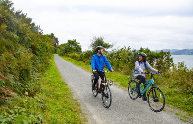
Dodder Greenway
 Ringsend





Overview
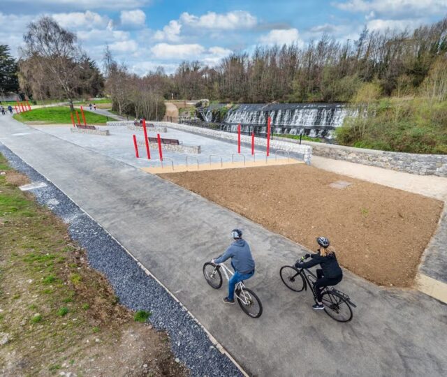
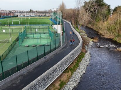
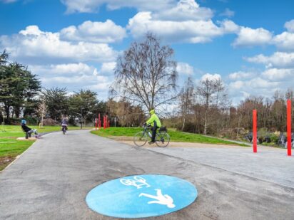
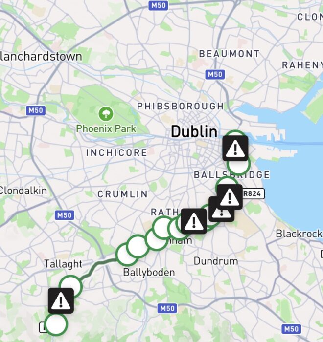
The river Dodder rises in the Wicklow mountains before descending via the Glenasmole valley and continuing through Tallaght, Templeogue, Rathfarnham, Milltown, Donnybrook and Ballsbridge before entering the River Liffey at Ringsend. In recent years, significant investment has been made to ensure a continuous 16km walking and cycling route along the River from Kiltipper to the mouth of the River at Ringsend. This route is nearly completed with only a small number of sections remaining that require infrastructure for cyclists and/or walkers.
This largely green corridor follows the river from mountain to sea and provides a respite from the bustle of the surrounding urban environment connecting residential neighbourhoods, parks, workplaces and schools, offering both a commuter corridor and a recreational amenity. Follow the Dodder’s watercourse through suburban parks and thriving habitats, offering glimpses of kingfishers, herons, and otters, intertwined with historic remnants of an industrial era that was powered by this fast-flowing river.
Kiltipper Park - Dodder Valley Park
Beginning at Kiltipper Park, travel through the park exiting on the Kiltipper Road. Continue on the shared traffic road before reaching the Old Bawn Road. Turn left taking advantage of a protected cycleway and footpath before turning right into the Dodder Valley Park. You will travel through the park for the next 3.5km passing under the M50 and continue to cycle adjacent to the river until you exit the park onto the Firhouse Road.
Dodder Valley Park - Ely's Arch
Ely’s Arch – Donnybrook
Donnybrook – Ringsend
Download Your Route
Amenities
- Parking
- Refreshments
- Playground
- Bus Stop
- Bike Parking
- Bike Repair
- Water Fountain
- Picnic Area
- Historic Site
- Bike Hire
- Restaurant
- Accommodation
- Tram
- Bridge
- Toilets
- Train Station


The River Dodder and its surrounding landscapes form a vital green corridor, sustaining wildlife and biodiversity in an urban environment. In addition to providing refuge and commuting habitat to countless species, including the otter, badger and kingfisher, the river supports several bat species, including the Daubenton’s bat. Several rare plants have also been recorded along the river. Enhancement measures aimed at improving green linear infrastructure along the route, including augmented native planting and the implementation of mowing regimes, have also been implemented as part of commitments in this regard.
In the Dodder Valley Park, two Integrated Constructed Wetlands (ICWs) have been created to improve water quality and enhance wildlife habitats. These wetlands act as nature-based solutions, filtering stormwater runoff from roads and rooftops before it reaches the River Dodder. Designed as shallow, planted ponds, they mimic natural wetland processes, reducing pollutants such as ammonia and harmful bacteria like E. coli, while also helping with flood control and providing water storage during dry spells.
Beyond water treatment, the Integrated Constructed Wetlands created vibrant ecosystems that support a complex biological system of plants, animals, microorganisms and hopefully frogs, newts and birds. Native, pollinator-friendly plants and trees were added to boost biodiversity and make the wetlands visually appealing for park visitors. Local community groups played a key role in planting, fostering a sense of ownership and connection to the environment. This project demonstrates how green infrastructure can deliver ecological benefits while enriching public spaces, offering cleaner rivers, healthier habitats, and engaging natural areas for everyone to enjoy.

Code of Conduct
To keep our greenways welcoming and safe for all users—walkers, cyclists, families, and wildlife alike—please review our Code of Conduct before you go.
Read Code of ConductGetting There
Whether you’re travelling by train, bus, or car, use these tools to plan your route.
Common Questions
The route is continuously accessible via the many park entrances such as the Dodder Valley Park, Kilvere Park, Bushy Park, Dartry Park and Herbert Park. The on-road links connecting these parks are openly accessible at any point. This is an urban Greenway that has many access locations along the route at junctions.
Multiple Dublin Bus routes traverse the urban sections of the Dodder Greenway, providing frequent and convenient access from across the city.
Dart services cross the eastern side of the route with a train station at Lansdowne Road. The green Luas line also interfaces with the greenway route with a stop at Milltown.
See more information on timetables on www.transportforireland.ie
Regular and accessible parking is available at the Dodder Valley Park parking locations namely; Old Bawn Pavilion, Firhouse Dodder Valley Park carpark and Cherryfield Dodder Valley Park carpark.
There are many carparks an on-street pay and display parking locations along the route.
There are numerous public EV chargers along the route, see more information here.
The entire route is smooth with no gravel surface present along the route.
There is a water fountain located in the Bushy Park Carpark off Dodder View Road. This is adjacent to the Bushy Park red pedestrian bridge.
There are bike parking facilities located at the following locations
Dodder Valley Park Firhouse Carpark
City Weir at Firhouse
Rathfarnham Junction
Elys Arch (Rathfarnham) on the Dodder Road Lower
Darty Park (bottom of Dodder Walk)
Donnybrook Road (opposite Eglinton Road)
Newbridge Avenue at the junction with Lansdowne Road/Herbert Road
Thorncastle street (opposite church)
Fitzwilliam Quay (Dermot O Hurley Junction)
Thorncastle Street (St Patricks Rowing Club)
There is a bike repair station at the City Weir in Firhouse (just before the M50 underpass).
There are bicycle repair shops along the route, the locations mentioned below are located close to the Dodder Greenway- Bear Cycles (109 Clonskeagh Road) and Hollingsworth repair shop (Templeogue village) – Templeogue is accessible via the red cycling and pedestrian bridge within the Kilver Park section of the Greenway.
Bikes may be available from shared bike operators such as Dublin Bikes, Bleeper, and Moby. There are stations located in Ringsend – further details can be found online.
There are benches located at the following locations:
Elys Arch – Dodder Road Lower
Dartry Park
Grace O Donnell Memorial Park
Donnybrook Road (beside Donnybrook Stadium)
Dodder Trail (after Packhorse Bridge)
Herbert Park
Picnic benches are also situated at with picnic benches at Ely’s Arch, Rathfarnham.
There are public toilets located in Herbert Park.
The greenway route within Dodder Valley Park is rich with amenities as follows:
Old Bawn Dodder Valley Playground
Old Bawn Dodder Valley basketball and tennis courts
Firhouse Dodder Valley Playground
Cherryfield Dodder Valley Playground
BMX Pump Track
Bushy Park Playground
Bushy Park tennis and padel courts
Bushy Park skatepark
News and Updates
View All
Grand Canal Greenway Update
Royal Canal Greenway Update