North West Network Greenway – Derry to Three Trees
 Three Trees





Overview
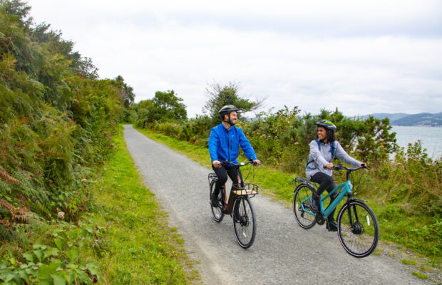
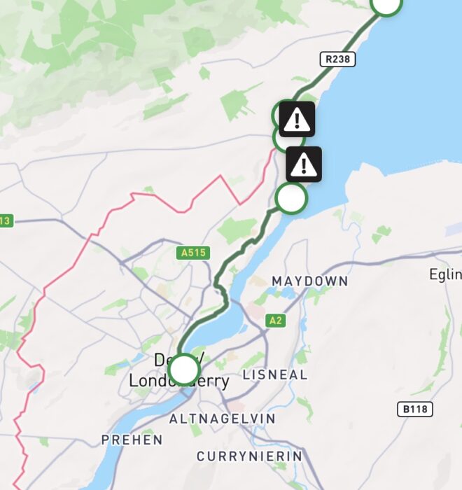
The Derry to Three Trees Greenway is a cross-border route spanning Counties Donegal and Derry, running from Derry City into the Inishowen peninsula offering breathtaking views out to Lough Foyle. This 17km route offers a mixture of urban and rural landscapes with wide paths, fresh air and great views across the water. The route commences on the shores of the River Foyle in the heart of Derry, Ireland’s only fully intact walled city. The 17th century walls (complete with 24 canons) are easy to access from the route and offer commanding views over the city.
The route is directly connected to Derry’s extensive active travel network including the riverside network, the Foyle valley greenway network with the waterside network linked by the peace bridge leading to the Strathfoyle greenway network. This route contains a mixture of different terrains including offroad sections running through parks, cycling and walking spaces protected from the road via separation and kerbs as well as quiet low trafficked laneways.
Derry – Muff
The Greenway commences along the banks of the Foyle in the Derry City Centre where there is ample parking for vistitors. The traffic free route then follows the Foyle downstream along the quays through Bay Road Park nature reserve. Leaving Bay road park the greenway travels uphill under the majestic Foyle bridge and passing Boom Hall on the way to Inishowen and County Donegal. Please note the last section in the park involves a steep gradient.
The greenway continues along the A2 (there is a traffic crossing near the park exit), using a shared footpath and cycleway separated from the road by a raised kerb and grass verge. After approximately 2 kilometers, you will turn right onto Culmore Point Road (there is a traffic crossing) – there is a shared footpath and cycleway separated by a raised kerb on this low trafficked road, be mindful of the steep descent. Cycling adjacent to the shoreline, you can look across to the commercial port on the other side of the river. A short detour (C.600m) leads to the recently renovated Culmore fort and the lighthouse. Alternatively continue straight ahead along the Corey Road – again there is a shared footpath and cycleway separated from the road by a raised kerb. After a short distance, you will pass the entrance to Culmore country park – a 40 hectare park with 3km of pathways and plenty of seats to take a break and enjoy the lovely waterside views.
Beyond Culmore Country Park, the route follows a quiet road for 1km to the border at Muff. Once in Muff, you have the opportunity to visit the vibrant village centre using the signed active travel network or travel along leafy lanes to the east of the village emerging near the Muff community park. Muff serves as a natural midpoint with a rest area that where you can avail of before continuing your journey. Muff is home to the Muff Liquor company with the visitors centre offers a unique tour and tasting experience.
Muff – Three Trees
Continuing your journey

Need to Know
Gradients are generally gentle along the route though there is a steep ascent/ descent from Bay Road Park to the A2 (Culmore Road) as well as along the Culmore Point Road.
Download Your Route
Amenities
- Parking
- Picnic Area
- EV Charging
- Restaurant
- Playground
- Refreshments
- Bike Parking
- refreshments
- Bus Station
- Bridge
- Bus Stop
- Train Station
- Toilets
- Picnic Area
- Bike Repair
- Viewing Point


Extensive work has been completed by the local community in Muff to integrate their village with ecological best practices as well as enrich local community assets. Initiatives include wildflower and native tree planting which provide essential habitats for pollinators such as bees and butterflies, while herbs and flowering shrubs add seasonal colour and ecological value.
This Greenway route also complements existing natural assets such as the Bay Road Park in Derry, a designated Local Nature Reserve. By linking these spaces, the greenway creates an extended ecological corridor, improving connectivity for wildlife and offering residents and visitors a scenic, nature-rich cycling experience.
The Greenway terminates at a sand and shingle beach at Tree trees overlooking the Lough Foyle Special Area of Protection, a site that supports over 20,000 wintering waterbirds including several international species.

Code of Conduct
To keep our greenways welcoming and safe for all users—walkers, cyclists, families, and wildlife alike—please review our Code of Conduct before you go.
Read Code of ConductGetting There
Whether you’re travelling by train, bus, or car, use these tools to plan your route.
Common Questions
As the route is located adjacent to the road network, entry and exit can be gained along the length of the route
Bus services that provide connection to the greenway include:
1 – Foyle Metro Derry to Wheatfields (Muff)
953 – Greencastle to Letterkenny
952 – Carndonagh to Derry
957 – Shrove to Derry
In addition, there are a multiple services connecting to Derry including Galway, Sligo, Dublin, Ballybofey, Strabane, New buildings, Belfast, Coleraine, Limavady, Artigarvan, Dungiven, Killea, and Letterkenny.
Train services to Derry are available from Portrush, Coleraine and Belfast.
Car parking is readily available near the riverfront of Derry city including 3 multi-story carparks from which access to the greenway can be easily obtained. Parking is available at Culmore Country Park from 8am to dusk. On street parking is available in Muff and parking is available in Muff Community park from 9:30am to 7:30pm
EV charging is available at Bay Road in Derry
Dedicated accessible car parking spaces are available in Derry
The entire route is smooth with no gravel surface along the route.
No water fountain facilities are available on the route.
Bike parking facilities are located at Derry shorefront, Bay Road industrial estate, Muff village, Muff community park and Three Trees trailhead.
There is a bike repair station at Three Trees trailhead.
There are bike hire operators based in Derry, further information can be found online.
Benches are located at Derry shorefront, Bay Road Park, Muff village, Culmore Country Park, Muff community park and Three Trees trailhead.
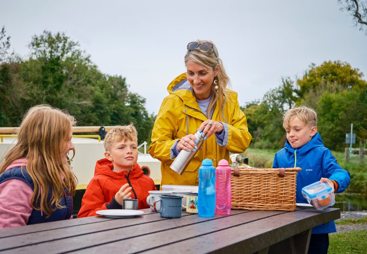
Picnic tables are located at Culmore Point road, Culmore Country Park, Muff community park and Three Trees trailhead.
Public facilities are available at Muff Community Park and Culmore Country Park.
There is a play area along the greenway located in Muff community park and Bay Road Park.
News and Updates
View All
Grand Canal Greenway Update
Royal Canal Greenway Update